Ticknall and Carvers Rocks, 22nd October 2017

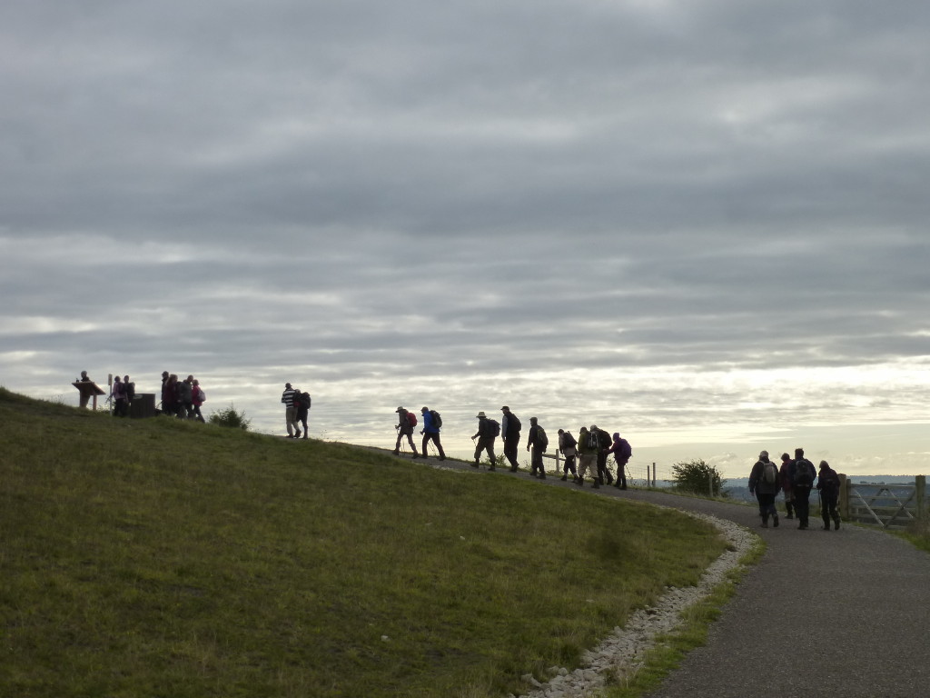
Phil took twenty of us on an interesting 7½ mile walk from Ticknall, round the edge of Foremark Reservoir to Carvers Rocks and then along the course of the old Ticknall Tramway, including its tunnels, to the old limestone workings that the tramway served.
The start at Ticknall Village Hall
St George's Church, Ticknall (1842) and the remains of the old church dedicated to St Thomas Becket and blown up with gunpowder in 1841
Foremark Reservoir - no picnics today


Carvers Rocks - Millstone grit sandstone crags, part natural outcrop and part man-made, were quarried in the 19th century for the construction of local buildings.
 
The Ticknall Tramway was part of a complex of tramways constructed to link the brickyards, lime quarries and lime yards of Ticknall to the Ashby de la Zouch Canal at the Willesley basin near Donisthorpe.
The Ticknall Tramway Tunnels (1802) are Grade II listed structures.  Comprising some of the oldest railway arches in the world, they were restored by the National Trust and converted into a footpath in 1995.

Ticknall Limeyards lime kilns were operating as early as the fifteenth century.  Lime was burnt to make mortar and plaster or to spread on the fields.
 
The good, the bad and the ugly (+1), not necessarily in that order
Note, this route was a Ramblers Route.  The description is good (providing you are on route!) but the GPS file downloaded from the Ramblers website was poor, with leg lengths averaging over 90m.  Route finding using the file was therefore difficult, especially in the woods near Carvers Rocks.

Collingham and Langford Nature Reserve, 18th October 2017

Seven walkers came on John’s walk around the Langford Lowfields at Collingham. This is an area where the RSPB and Tarmac are working in partnership to transform the sand and gravel quarry into a nature reserve.  It is still a work in progress but it has already attracted a large amount of wildlife
Langford Lowfields
Trying to spot the widlife - and the missing rambler
Cromwell Lock and Weir on the Trent - the tidal limit of the river.  On 28 September 1975, during an eighty-mile, night navigation exercise in extreme weather conditions, ten members of the 131 Parachute Squadron, Royal Engineers were killed after a power failure caused the navigation lights on the weir to go out and their boat went over the crest.
I counted them all out ...
 

Ladybower and Woodlands Valley, 15th October 2017

A select band of six accompanied John J on his ten-mile walk from Fairholmes and round the Ladybower Reservoir.
Climb up to Lockerbrook

Lockerbrook Outdoor Centre

Down to Hagg Farm and the Snake Road

Bridge over the River Ashop, Woodlands Valley
Ashopton Viaduct
Ladybower Reservoir overflow and dam.  Completed in 1943 but not filled for another two years

Ashopton, drowned in 1944
Derwent Reservoir Dam, completed in 1916
Incidentally, for those of you who are subscribers to OS Maps, there is a new, clever feature which can be used in the National Parks when creating a new route on the 1:25k maps.  You can now "snap" the route to one of the National Parks paths and the route detail is drawn for you - see Help on the OS toolbar.  

Also, on phones and tablets (only), you are now able to display icons of your own stored routes and tracks as well as others in the vicinity.  And OS have been promoting a new facility called Augmented Reality - it doesn't work on my tablet but let me know if you get it to work.


Gedling Country Park and Lambley, 8th October 2017

Jan's walk today started in Gedling Country Park, ...

... site of the old Gedling Colliery.

The main period of operation of the mine was between 1902 and 1991 and the pit exceeded one million tons in a year sixteen times between 1952 and 1969.  Parts of the mine were over 360m deep with tunnels that stretched out five miles.  The mine faces were up to 220m wide and there were 35 miles of roadway below ground.  In 1924 at its height of productivity, there were more than 3,884 men working there of which 3,257 were underground.  It developed a reputation as the "pit of all nations" because of the diversity of foreign miners who worked there - in the 1960s, ten per cent of the colliery's workforce of 1,400 were originally from the Caribbean. 

(Courtesy of https://u3asites.org.uk/files/c/carlton-gedling/docs/2015-07gedlingcolliery.pdf )

The site was opened as Gedling Country Park on 28 March 2015.

After stopping to admire the view to the south towards the Belvoir Ridge ...
All Hallows Church, Gedling with an apparently bulging spire, the second highest in Nottinghamshire
...the walk took us round the park ...
... firstly downhill on the park's excellent tracks towards Gedling Village, ...
 ... then uphill...

... around the adjacent solar farm.  
Plans for this farm, on a site which had been derelict for 20 years, were initially described by some as an act of environmental vandalism and gross irresponsibility - you can never satisfy some people.  For the record, it covers 14 hectares, has over 23,000 solar photovoltaic (PV) panels each rated at 240W for a total installed capacity of about 5MW, enough power for 1700 homes.

The colliery site also hosts a methane extraction plant which  extracts methane through a borehole and uses it to power generators on site producing "sustainable" energy.  

Then the walk took us on high ground above Burton Joyce before descending to cross the Lambley to Lowdham road and then up towards Woodborough and yet more high ground (an impressive 300m of climbing today) before descending to Lambley ...


... and returning along Lambley Dumble ...

... before climbing back up to the park.


Idle Valley Nature Reserve, 5th October 2017

Encouraged by the Notts Walker, we went to the Idle Valley Nature Reserve just north of Retford to see whether it is suitable for a future VBR walk.  We decided against, but just in case you birders want to explore it yourself, here are some photos.
ldle Valley Nature Reserve Centre


The Reserve has several waymarked paths thus.  The track above used the Riverside and Woodland routes


River Idle heading for the River Trent at West Stockwith
Himalayan balsam - in profusion here
Red admiral
Some of the birds we didn't see


View from Centre cafe