Cossal, Nottingham Canal, Bennerley Viaduct and Strelley, 29th May 2022


Today's walk explored the landscape created by coal mining in and around the Erewash Valley, the canals and railways and in particular the Bennerley Viaduct.  Eighteen members turned out for the longer, 8.7 mile walk through Awsworth and Babbington and across the M1 to Strelley with three others returning from the viaduct to the start via the Erewash Canal.


Lunch was taken at All Saints Church near Strelley Hall (now a business centre) before returning to the canal along excellent tracks with across Nottingham to Beacon Hill in Charnwood and the Belvoir Ridge.  Also visible was Wollaton Hall, connected to Strelley in 1604 by a wagonway, an early form of railway with carriages drawn by horses on sawn wooden rails.

The start next to the Nottingham Canal

View of the viaduct from the short section of the Nottingham Canal we did not use, just south of Awsworth

The Bennerley Viaduct, opened in 1878, formed part of the Great Northern Railway Derbyshire Extension which was built in part to exploit the coalfields in Derbyshire and Nottinghamshire.  The foundations were subject to a great deal of coal mining subsidence and therefore a lighter, flexible wrought iron design was chosen.  It is now a Grade II listed structure, one of only two similar viaducts in the UK

Yellow flag iris, water lilies and birdlife on the canal

Short cut

Access to the deck of the viaduct is from below, over the nearby railway bridge and up to the Erewash Canal

Stone capped, blue-brick foundation bases used to support the wrought iron columns near the River Erewash
Coffee stop on the new decking of the viaduct,  recently re-opened following fifty years of closure and a £1.4 million investment - see Friends of Bennerley Viaduct
View from the deck - to the south, Bennerley Marshes, the wetlands next to the Erewash River affected by mining subsidence, and ...
... to the north, the site of the old Bennerley Colliery (1855-1873) and Ironworks.  Surprisingly, opencast mine working continued in the Erewash Valley until 1999
Near Babbingtonn, a rare example of a rambler gate, aka self-closing stile - unusual but simple and functional

Euclid scrapers, abandoned after the construction of the neaby M1 (allegedly)

Next to Strelley Hall, these stone pavings, which can also be found in Cossall and Ilkeston, are all that are left of the Monks Ways that linked nearby monasteries and provided access to Nottingham and the River Trent

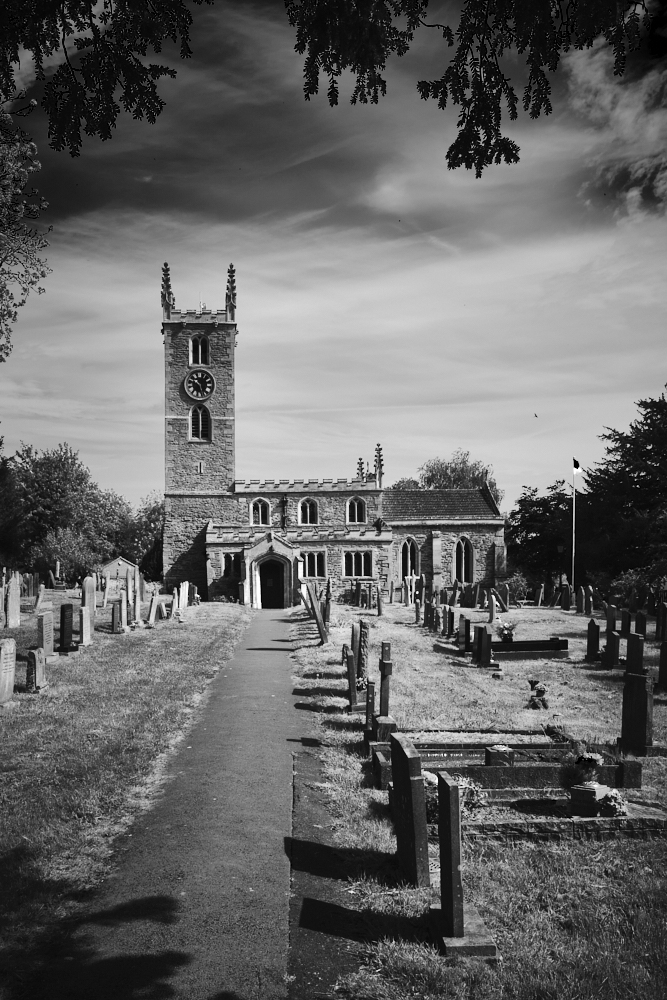
All Saints Church, Strelley - lunch

Back on the Nottingham Canal near its Robbinetts Arm

Backmarkers pass the abundant yellow irises

Rod's shorter version (in red) returning along the Erewash Canal


Epperstone and Halloughton, 22nd May 2022

On this fine day, starting at Holy Cross Church in Epperstone, Howard led thirteen ramblers and Carrie across fields and farm tracks to Halloughton. There were just two easy stiles within the first two hundred yards and only gates thereafter.  A couple of long, gentle hills tested our legs.

Thanks Steve, Andy and Howard for the photos and route.

Howard briefs the members

Holy Cross Church nestling in the middle of Epperstone

Holy Cross Church

Howard leads ...

... and Carrie takes up the rear

Skyscape

Unusual guyed wind turbine with rotor downwind of the tower

Coffee

Halloughton Dumble

Lunch

Rewilding?


Redmile and Muston Meadows, 18th May 2022

Brenda took eight members on this 7-mile walk from Redmile to see the orchids in Muston Meadows making full use of the Grantham Canal on the way there and back.

Brenda does some pruning on the canal

Geese and goslings

Our leader and Jan

Green winged orchid ... 

... and yellow rattle

Mixed flowers

Longore Bridge, #58

Teqball table in Redmile.  The game is a combination of football and volleyball.  Opponents must not touch each other!


Syerston, Elston and East Stoke, 15th May 2022


Fiona's walk took seventeen of us on this interesting 8-mile walk from the church in Syerston to Elston to visit its medieval chapel before heading towards East Stoke past the site of the Battle of Stoke Field.  Passing Stoke Hall, we dropped down to the Trent opposite Fiskerton for lunch.  We then walked along excellent fishermens' paths towards Hazelford Weir before climbing up to higher ground and back to Syerston.

Thanks Andy for the photos.


The start at All Saints Church, Syerston

All Saints Church, Elston

Elston Chapel, a Grade I listed building containing a fine Norman south doorway with zigzag decoration. It is thought it may have been the chapel of a medieval leper hospital dedicated to St Leonard

Inside are layers of interesting wall paintings

View over the wall - Stoke Hall, a Grade II listed mansion, now a wedding venue

St Oswald's Church, East Stoke

Fine memorial to Baron Julian Pauncefote (1828 - 1902), Ambassador to the United States (1893-1902) who was buried in East Stoke

In 1487 East Stoke was the scene of possibly the bloodiest battle in British history, the Battle of Stoke Field, between Yorkist rebels facing the army of Henry VII. Towards the end of the battle almost all the Yorkists were chased down and captured or killed. The River Trent is said to have run red with blood.

The track down to the Trent was known as the Red Gutter and is said to be the area where the massacre took place, although it is unclear whether this feature is so called due the blood split there during the battle or whether it derives its name from nearby red clay deposits

Fiskerton Ferry jetty - still in use today.  References to a ferry at Fiskerton were first mentioned in the Domesday Book. Horses and carts used to be able to ford the river so Fiskerton was the main river crossing point on a principal route between Newark and Nottingham

Across the Trent is The Bromley Arms, owner of the landing rights on both sides of the river

Syerston Pinfold, restored for the Golden Jubilee in 2002