Rushcliffe Country Park, Bradmore, Bunny and Gotham, 26th November 2023


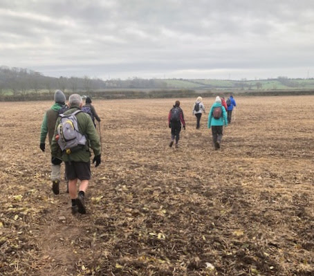
Rab led ten ramblers on a 9½ mile walk starting from Rushcliffe Country Park. The air temperature was at 0°C and the ground was frozen reducing the muddy conditions - flat walking with not  a single stile! 

The route went south to Bradmore and Bunny and then west across Bunny Moor and under the Great Central Railway to Gotham. From there we headed back across Gotham Moor and then back along the side of the railway.

Thanks Steve for the photos and John J for the route.
The start in Rushcliffe Country Park

Heading out


The old Schoolhouse in Bunny

St Mary's Church, Bunny

Bunny Moor

Under the Great Central Railway
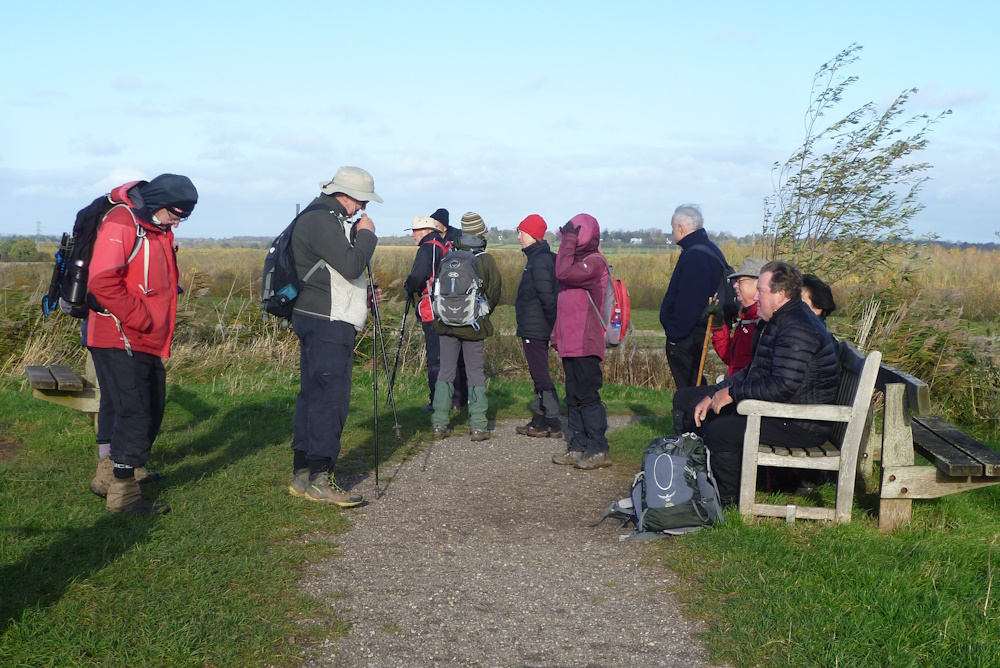
Lunch in Gotham

Fine wall paintings in Gotham

St Lawrence's Church Gotham

Fairham Brook on its way from near Old Dalby to join the Trent near Clifton Bridge. Shown here draining The Moors, a flat fenland landscape

The way back - along the Great Central Railway line from Sheffield to London (not all the way) 


Whatton and Orston and the River Smite AGM Walk, 19th November 2023


 Paul's 5.2 mile (muddy) walk took us from Whatton Village Hall along Orston Lane to the church in Orston for coffee before joining the River Smite and following it to Aslockton and then back to Whatton for the tea and cakes and the VBR AGM.

The start at Whatton Village Hall

The River Whipling about to join the Smite.  Its catchment includes Langar and Redmile and other villages below the Belvoir Ridge
Orston Lane - the front runners ...


... and the rear guard

Below the Nottingham to Grantham railway

Orston Plaster Pits  next to Moor Lane. Follow the link to a map of Orston's gypsum works and its interesting history

Coffee stop at St Mary's Church, Orston

St Mary's Church

Inside the church is a drum used at the Battle of Waterloo in 1815 and subsequently used by the village band at the annual Orston Friendly Society Club Feast

First sight of the River Smite draining 75 square miles of the Vale of Belvoir from Holwell near Nether Broughton to Shelton where it joins the River Devon

Gibson Bridge, created for Millennium celebrations, crosses the River Smite here and provides a short, circular walk around Orston

Stretched out along the embankment of the River Smite.  The river originally meandered between Aslockon and Orston but has been canalised to avoid flooding.  There is still a 1% per year risk though as shown on this map of the Rivers Smite and Devon catchments

Nearing Aslockton

Cranmer's Mound is named after Archbishop Cranmer, who was born in Aslockton in 1489.  It was originally a motte-and-bailey castle but  only the earthworks now remain.  These are visible from the footpath.  Zoom in for more information

A History of Thomas Cranmer on Main Street, Aslockton

Aslockton Railway Station


The Church of St John of Beverley, Whatton, one  of the Cranmer Group of parishes formed in 1967 embracing the villages of Aslockton, Hawksworth, Orston, Scarrington, Thoroton and Whatton


Cotgrave Country Park and Radcliffe on Trent, 15th November 2023

Val and Dave's 7.8-mile walk started in Cotgrave Country Park before crossing the Stragglethorpe road and climbing over to Radcliffe on Trent for a coffee stop.  Then we walked down Holme Lane to meet the 3km disused railway line, the former mineral railway which used to link the colliery in Cotgrave to the main railway network and now a multi-use walking and cycling track.
The start in the car park

Setting off

Distant views of Nottingham from high ground near Radcliffe

Gazebo next to Grange Hall, Radcliffe - lunch stop

In 1956 the Canadian RAF moved to RAF Langar and many of their families joined them. 205 new homes were built in Radcliffe as married quarters for airmen. The housing estate is known locally as the Canadian Estate

Leaving Holme Lane to climb up to the old railway

Blackberry Solar Farm (4.2MW) viewed from the railway line.  An example of co-cropping - using land both for energy and agriculture, in this case sheep farming

Grantham Canal Lock 6

Resting on Windmill Hill near the site of Gozen's Hill Mill which was blown down in 1916  The mill was of the post type where the whole body of the tower could be moved by hand in order to face the wind.  Good views to the south west all the way to Ratcliife Power Station


Kneesall and Laxton, 12th November 2023

On a misty, moisty morning on Remembrance Sunday,  Howard led this well-researched, 8.2 mile walk starting at the School Lane car park just behind Kneesall Church before heading across fields to Laxton to visit the Castle and Visitor Centre.
 
Howard briefs the members and visitors

St Bartholomew's Church, Laxton

Setting off

Remembrance Sunday - two minutes silence 

Coffee stop near Golden Hill reservoirs

Heading towards West Field

Laxton retains a significant part of the medieval open field system.  Fields, divided into strips, were farmed in common among the landowners of the village.  Today, there are three open fields remaining; the Mill Field, the South Field and the West Field.  In 1655, about 346 acres of West Field were worked as open fields in 412 strips.

A network of tracks was developed to take animals and farm machinery to and from the fields.  In places, they have been worn down deep into the soft clays by heavy traffic over the centuries, producing a sunken track known as a hollow way

Example of the many farms (unusually) close to the centre of the village

Late 11th- or early 12th-century, medieval, motte-and-bailey castle

Heading towards the earthworks of Laxton Castle
On top of the earthworks, good views all round

The Readyfield Bloodhounds don't hunt foxes but follow a runner who is given a prepared route trailed by the horses and riders.  When the hounds find his scent and follow it until they catch him, they lick him rather than attacking.  Ugh!


The three fields of strip farming, West Field, Mill Field and South Field

Watching a video at lunch inside the Laxton Visitor Centre for some ...
... or in the nearby pinfold for others

Passing behind St Michael the Archangel's Church, Laxton 

Just south of Laxton and along the valley of the local stream are nine fishponds made by digging out earth from the hillside and then banking it up on the streamside at each end