Ironville, Codnor Castle and the Cromford Canal, 10th October 2021

Ironville, possibly Derbyshire’s best example of a mid-nineteenth century model village, was created between 1834 and 1860 by the Butterley Company to house its workers at the nearby Codnor Park Ironworks which operated until the 1970s. The village, which stands at the junction of the Pinxton and Cromford Canals, is known for its houses built from iron slag, those on Forge Row near the start of the walk being a fine example.

Starting at Codnorpark Reservoir, John's well-attended 8.5 mile walk took us through Ironville up to the remains of the 13th century Codnor Castle before dropping down to the Erewash Meadows Nature Reserve and then up to the outskirts of Brinsley.  A long descent took us to the Cromford Canal before an interesting excursion to Jacksdale before returning to follow the canal back to the Codnorpark Reservoir.

The start - Codnorpark Reservoir

Example of house in Ironville built from iron slag

Wall of cottage in Forge Row made of clinker and brick

Notice board near site of the Codnor Park Ironworks

Codnor Castle.  These two photos were taken in February 2020 before the castle was fenced off by the Codnor Castle HeritageTrust to protect it


Coffee stop at Codnor Castle

(Some) men at work on the Nottingham to Sheffield Midland Main Line

River Erewash - the border between Derbyshire and Nottinghamshire

Cromford Canal

Jacksdale Wharf and Basin.  Examining the embankment made out of slag blocks manufactured in the ironworks

The Portland Tramway connected the Portland Collieries in Kirkby in Ashfield to the Cromford Canal
 wharf in Jacksdale and the Butterley Ironworks over the River Erewash in Codnor Park

Bridge at the junction of the Cromford Canal and its Pinxton branch


Eaton, Branston and Eastwell, 3rd October 2021


Paul's eight mile walk today explored the headwaters of the River Devon which drains into Knipton Reservoir, eventually joining the Trent at Newark Marina.  From the Village Hall at Eaton we walked north on the Jubilee Way before joining the route of the annual Viking Challege off-road cycle ride, stopping in Branston for coffee.


From there we eventually rejoined the Jubilee Way for a short distance before walking up to Eastwell for lunch at the church.  There followed some challenging stiles on a path alongside the Devon before turning uphill to return to Eaton.


Briefing (warning actually) at Eaton Village Hall

The Jubilee Challenge walking route

The Viking Challenge bike route

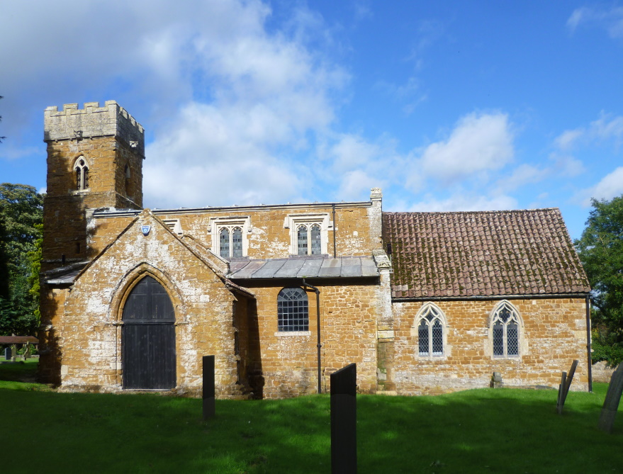
St Guthlac's Church, Branston - coffee

St Michael and All Angels Church, Eastwell - lunch
Bug hotel at Eastwell church

Descent to cross the River Devon (just a trickle here)

Click here for an interative OS map


Nether Broughton and Long Clawson, 26th September 2021

Fiona led nineteen ramblers on a 7.3 mile walk starting from Nether Broughton church up Slyborough Hill to Long Clawson for a coffee stop next to the village water pump.  Later we passed Mill Farm with its resident windmill.

Walkers interacted with alpacas, shire horses and young bullocks, with Phil demonstrating his ‘cow whispering’!

We passed through Howell Mouth and took lunch in open fields before returning via Bleak Hills to Nether Broughton. It was a hot sunny day and many walkers enjoyed an ice cream from the van at the finish.

Fiona briefs us

St Mary the Virgin Church

Our leader(s)

Village pump, Long Clawson

Long Clawson Windmill at Mill Farm showing the characteristic Lincolnshire-style cap

Shire horses

Alpacas

Lunch stop

Good to see our back markers

If I could talk to the animals, just imagine it

Ices

This image shows thumbnails of Steve's photos (above) superimpsed on an OpenStreetMap.  The images had been geotagged  by his smartphone which adds latitude and longitude data to the files' metatdata


Hoby, Rotherby, Rearsby and Ratcliffe, 19th September 2021

Maggie and Glen's walk, a repeat of a mid-week walk in 2020, took twenty seven VBR members and five guests from Gedling up and down the Wreake Valley from The Blue Bell Inn in Hoby to follow the Leicestershire round to Rearsby for coffee.  The group split with eighteen returning to Hoby via Rotherby whilst the others continued down the Wreake to Ratcliffe returning to Rearsby for lunch and then to Rotherby and Hoby.


The start outside the Blue Bell

Old mill house on the Wreake

Packhorse Bridge over Rearsby Brook. The original wooden bridge would have been medieval, but was replaced in 1714 by the one we can see today


Coffee stop for all the group in Rearsby and lunch stop later for some

Rearsby Mill

Entrance to Ratcliffe Water Mill

Maize

Brooksby Hall, a late 16th century manor house

All Saints Church Rotherby - rest stop

Waterhouse Bridge

This beautiful brick bridge was built in 1794 by the Melton Mowbray Navigation Company as part of work to make the River Weake navigable from Syston, where it joins the Leicester Navigation, to Melton Mowbray where it linked with the Oakham Canal

Leicestershire Round in green