This walk was originally planned for February but no complete recce was possible due to extreme flooding. A second attempt was succesful and led to today's 9½ mile walk led by Paul.
So, starting at the free car park at the bottom of Main Street and next to the Midland Main Line, we dropped down to the Grand Union Canal in Barrow and followed it on paths rather than towpaths as it joined and rejoined the River Soar on a winding route to the outskirts of Mountsorrel for a coffee stop.
Afer continuing along the canal, we left it at Sileby Mill and from the village we climbed up by Sileby Brook to the pleasant village of Seagrave in the Leicestershire Wolds for lunch. Then we dropped back down to Barrow with fine views over the Soar Valley to Charnwood, Bradgate Park and Beacon Hill in the distance.
 |
| Paul's earlier attempt at the walk thwarted by flooding |
 |
| First sight of the Grand Union Canal |
 |
| Pleasant walk back to the canal after crossing Bridge Street in Barrow |
 |
| Known locally as the Navvy, the Navigation Inn on Mill Lane, Barrow was built soon after the opening of the canal in 1794. It provided beverage for the barges and stabling for the horses |
 |
| Bridge over weir |
 |
| River Soar leaves the Grand Union Canal (again) |
 |
| Outskirts of Barrow |
 |
| Fine Dutch-style houses at Mountsorrel Quay, each with a private mooring |
 |
| The former Midlands Railway Mountsorrel branch is now occupied by a covered conveyor that carries the aggregate from Lafarge's Mountsorrel Quarry to the mainline railway |
 |
| The Waterside Inn (1795), Mountsorrel Lock (coffee stop) |
 |
| Mountsorrel Lock |
 |
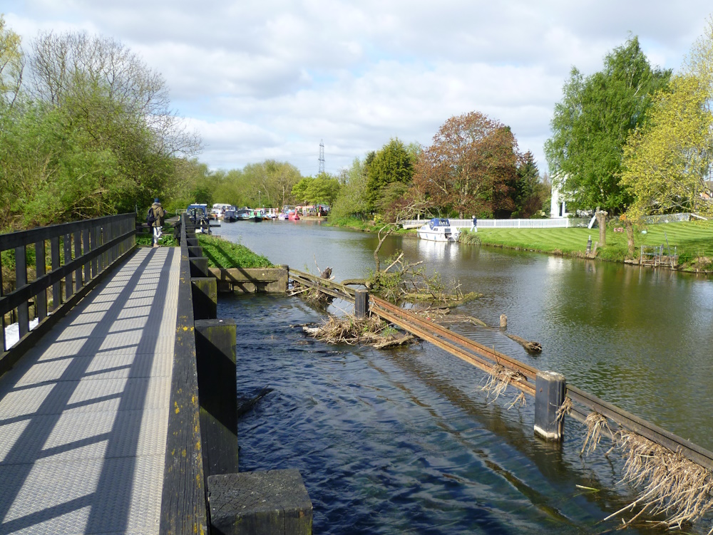
| Bridge and weir where the River Soar leaves the canal (again) |
 |
| One of many footbridges over the canal or river, this one near Sileby |
 |
| Leaving the canal at Sileby Mill |
 |
| The Grade II facade of The Maltings, Sileby, the former brewery buildings now converted into luxury accommodation |
 |
| All Saints, Seagrave |
 |
| White Horse Inn, Church Street, Seagrave |
 |
Lunch in the very pleasant heart of Seagrave.
The bench commemorates the Paltinum Jubilee of Queen Elizabeth II, 1952 - 2022 |
 |
| Fine acers in Seagrave |
 |
| Heading back through the newer outskirts of Barrow |
 |
GPS devices record data every second and use this immediately to calculate the distance walked. When not moving, random variations in the signal add to the distance travelled, errors which are much smaller when moving. So today the indicated GPS distance was 10.3 miles whereas the true distance (stored only every 20 metres) was 9.5 miles
|
 |
| This walk is part of a series aimed at covering the whole of the Grand Union Canal and River Soar from Abbey Park in Leicester to the River Trent. The walks in red are those actually done by VBR, those in blue are either proposed walks or short recces. Note in particular the absence of walks we have done between Barrow (circled) and Loughborough and from Ratcliffe on Soar village to the Trent (top) |