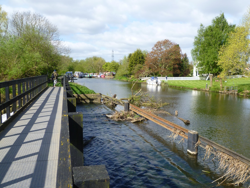
Woolsthorpe Wharf, Denton, Harlaxton Wharf and the Grantham Canal, 12th May 2024

From the Dirty Duck (presently closed) Dave's 7.4 mile walk went along the Grantham Canal to Longmoor Bridge where it briefly joined the Viking Way as far as the disused ironstone railway.  After following this as far as Belvoir Road, the route dropped down into Denton Village, circumnavigated Denton Reservoir and then went across fields to Harlaxton Wharf for lunch.  A stroll took us back along the canal to the start.

Thanks John J for some of the photgraphs.

View of the Dirty Duck through Woolsthorpe Bridge

One of several Sustrans signs on the canal

Locks near the start

Grantham Canal Society's cruise and maintenance boats

Longmoor Bridge

Approaching the ironstone railway along the Viking Way.  The railway was used to transport ore away from the quarries around Harlaxton and Harston to the Nottingham-Grantham line at Muston

Coffee stop where the disused railway passes below Denton Road

Grade II listed almshouse cottages in Denton built in1869 by the Welby Estate  


Blue-green algae at Denton Reservoir

The Denton Reservoir Loop

Lunch at Harlaxton Wharf

Back along the canal

Bridle Bridge

Twenty two members and guests on the walk on one of  the hottest day of the year
Distance 7.4 miles, total ascent 34m!


West Leake and West Leake Hills, 5th May 2024

Sue's 6-mile walk took eightteen of us up to the West Leake Hills along tracks and through Crow Wood, past the golf course and back along a mixture of quiet lanes and field paths.

The start near St Helena's Church, West Leake

The Cuckoo Bush mound is the alleged site for the tale of the Wise Men of Gotham’s attempt at fencing in the cuckoo but is actually a Neolithic burial mound. It is about three thousand years old and it was excavated in 1847

A constant companion down in the Trent Valley
You don't know what you've got 'til it's gone
To be decommissioned in September - or not!

Rushcliffe Golf Club

Heading back towards West Leake

Another constant companion - heading to EM Airport

Recrossing Kingston Brook

Approaching St Helena's Church

The end


Woolsthorpe Wharf, Denton and the Grantham Canal, 28th April 2024

This walk, to be led by John J,  was originally planned for the 28th April but, because of very poor weather,  has been postponed until 12th May to replace Angela's walk from Cossington.  Description follows:

From the Dirty Duck (presently closed) the 7.4 mile walk goes along the Grantham Canal as far as Longmoor Bridge where it joins the Viking Way as far as the nearby disused ironstone railway.  After following this as far as Belvoir Road, the route drops down into Denton Village, circumnavigates Denton Reservoir and then goes across fields to Harlaxton Wharf for lunch before following the canal back to the start.

More photos can be found on John's Relive video here, made on the recce.

The Dirty Duck at Woolsthorpe Wharf


Croxton Kerrial and Harston, 23rd April 2024

Tina's 3.7 mile, morning walk took ten members from the church in Croxton over rolling countryside to Harston for coffee, returning through the old ironstone quarries and through Harston Wood to view the bluebells.

At the end, we visited the remains of Croxton Kerrial Manor House, discovered and excavated recently and now open as a tourist attraction.


St Botolph and St John the Baptist Church

Some of the hundreds (thousands?) of free-range poultry en route, protected from overhead kites by the bird scarer

At the top is a depiction of Anglo-Saxon stonework set in the east wall of St Michael and All Angels Church, Harston

Croxton Lane, approaching Harston

St Michael and All Angels Church - coffee stop

St Michael and All Angels

Fine view from the church over the rolling countryside

Bluebells in Harston Wood

It is thought that the Croxton Kerrial Manor House was the home of the Lords of the Manor of Croxton from the 12th to the 14th century, including the ‘de Criol’ family who gave their name to the village

Remains of the Manor House, open to the public

How the village may have looked in the 13th century

A 12th century glazed pot found in the 4 meter deep well

The garde-robe, (medieval toilet)

Display of artifacts in the church found during the excavation

Anglo Saxon siver coin


Barrow on Soar, Grand Union Canal, Sileby and Seagrave, 21st April 2024


This walk was originally planned for February but no complete recce was possible due to extreme flooding.  A second attempt was succesful and led to today's 9½ mile walk led by Paul.

So, starting at the free car park at the bottom of Main Street and next to the Midland Main Line, we dropped down to the Grand Union Canal in Barrow and followed it on paths rather than towpaths as it joined and rejoined the River Soar on a winding route to the outskirts of Mountsorrel for a coffee stop.

Afer continuing along the canal, we left it at Sileby Mill and from the village we climbed up by Sileby Brook to the pleasant village of Seagrave in the Leicestershire Wolds for lunch.  Then we dropped back down to Barrow with fine views over the Soar Valley to Charnwood, Bradgate Park and Beacon Hill in the distance.
Paul's earlier attempt at the walk thwarted by flooding


First sight of the Grand Union Canal

Pleasant walk back to the canal after crossing Bridge Street in Barrow

Known locally as the Navvy, the Navigation Inn on Mill Lane, Barrow  was built soon after the opening of the canal in 1794. It provided beverage for the barges and stabling for the horses

Bridge over weir

River Soar leaves the Grand Union Canal (again)

Outskirts of Barrow


Fine Dutch-style houses at Mountsorrel Quay, each with a private mooring

The former Midlands Railway Mountsorrel branch is now occupied by a covered conveyor that carries the aggregate from Lafarge's Mountsorrel Quarry to the mainline railway

The Waterside Inn (1795), Mountsorrel Lock (coffee stop)

Mountsorrel Lock

Bridge and weir where the River Soar leaves the canal (again)

One of many footbridges over the canal or river, this one near Sileby

Leaving the canal at Sileby Mill

The Grade II facade of The Maltings, Sileby, the former brewery buildings now converted into luxury accommodation
All Saints, Seagrave

White Horse Inn, Church Street, Seagrave

Lunch in the very pleasant heart of Seagrave.
The bench commemorates the Paltinum Jubilee of Queen Elizabeth II, 1952 - 2022

Fine acers in Seagrave

Heading back through the newer outskirts of Barrow

GPS devices record data every second and use this immediately to calculate the distance walked.  When not moving, random variations in the signal add to the distance travelled, errors which are much smaller when moving.  So today the indicated GPS distance was 10.3 miles whereas the true distance (stored only every 20 metres) was 9.5 miles

This walk is part of a series aimed at covering the whole of  the Grand Union Canal and River Soar from Abbey Park in Leicester to the River Trent.  The walks in red are those actually done by VBR, those in blue are either proposed walks or short recces.  Note in particular the absence of walks we have done between Barrow (circled) and Loughborough and from Ratcliffe on Soar village to the Trent (top)