Clumber and Worksop, 27th March 2016

Phil led twenty one walkers on this walk starting from Clumber Park.
 
Strange objects in the woods (and a metal pillar)
Coffee break at Worksop Priory - the Priory Gatehouse contained the first ever elementary school in England

Walking through Worksop brought us back to open fields and a stop for lunch on a log pile in a woodland clearing.

Tunnel entrance used by the Duke of Portland to access his estate in secrecy
Finishing through woodland paths and exposed stones


Ambergate and Crich, 20th March 2016

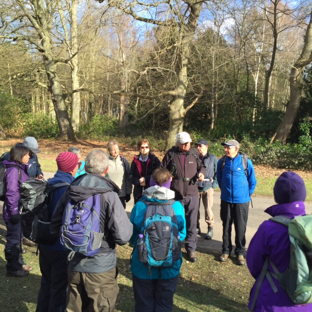
Eight fresh bodies started John's walk ...

... from Ambergate Station to Crich and the Amber Valley and ten miles and 930m of climbing (and descending) later eight tired bodies returned.
Ambergate Station looking up the Derwent Valley
 From the A6, we crossed under the Derwent Valley Railway ...
... and along the Cromford Canal ...
... before climbing up through Crich to the Beacon, built in 2002 to celebrate the Queen's Golden Jubilee.
 
Then across to Crich Stand.  This Memorial Tower was built in 1923 to commemorate the 11409 men of the Sherwood Foresters who gave their lives in the First World War and is further dedicated to the memory of members of the regiment killed in service since then.

We then descended into the farmland of the Amber Valley for lunch and then through pretty villages ...
... back to the more industrial part of Ambergate, in particular the site of the now demolished Stevenson's Dye Works.  The factory was constructed by the Stevenson family in the late 19th Century and provided employment to many people in Ambergate and the surrounding area.  At its peak in the 1970s the factory employed almost 1500 people.

The photograph below shows the cleared site and what (I think) is a branch of the Derwent Valley Aqueduct which supplies Nottingham with water from Ladybower.  The DVA is a 200km network of pipes and tunnels and is linked to Severn Trent's new Ambergate Reservoir which sits close to where we walked, on a hill above the town.  This is a major construction project to build the second largest covererd reservoir in Europe.  Follow the link to the video - it's worth watching if you are that way inclined.

Flintham revisited - Bill's photos

I couldn't decide which of my photos to replace with Bill's (all of them?) so I have included most of his below.  The walk description is in the earlier post.


Three medieval churches and a dovecote - Flintham, Syerston and Sibthorpe, 16th March 2016

This walk ...

.. was featured in the Nottingham Post ten days ago.  The full text is included after these images.

St Augustine’s Church, Flintham
 
Flintham Community Shop
All Saints Church, Syerston

Syerston Pinfold
St Peter's Church, Sibthorpe

Sibthorpe dovecote

Boot and Shoe, Flintham
Flintham Library
The walks starts near the first of the medieval churches, St Augustine’s in Flintham. Take a few minutes to walk round the church and have a look at an interesting old stone cross in the graveyard. 

Walk back to the road and turn left onto Inholms Road, past Flintham Village Hall, the Community Shop and the award-winning Flintham Museum. Go beyond the school and just after the road swings left, turn right down a footpath which skirts the edge of the sewage works to a wooden bridge, before heading directly across open fields towards Syerston. Go straight ahead, taking a short deviation around a fallen tree. 

At Longhedge Lane, a wide grassy byway, turn right but then immediately left through the hedge and along a footpath across the open field with Syerston in the distance. Continue ahead over stiles until at the second yellow-topped post on the outskirts of Syerston, leave the field and climb the stile into what appears to be someones garden, Keep well to the left and find a gap in the hedge to emerge on Main Street. Now turn left and walk up to the second of our churches, All Saints Church which probably dates back to the fourteenth-century. 

Retrace your steps and at a red post box, bear left along Moor Lane and past a pinfold on the right. After a deep water warning sign the road becomes a track and swings left. A further 100m on and on the right, cross the ditch on a small wooden bridge and follow the footpath sign to head south west along an indistinct field path and small wooden bridges towards a distant copse, Ash Holt. Head for the yellow post to the right of the copse and turn left along a muddy path which becomes a wide, raised track with distant views of Belvoir Castle. Now follow the track for about 1.3 km, swinging to the right and then sharply to the left to avoid an unsatisfactory field path. 

Cross Deadwood Lane and head along a track for the middle of farm buildings on the edge of Sibthorpe. Emerge onto the road and turn left, then swing right to follow the lane to St Peter's Church beyond which can be found the dovecote built in 1370. 

Retrace your steps through the village and take the Flintham road for 800m. As the road turns left, turn right along Longhedge Lane for 1.4 km. As a wide track to Syerston is reached on the right, turn left along a grassy track towards Flintham, past Hill Farm, hidden behind a distinctive copse of dark conifers. Regain Inholms Road and turn left to reach the start point.

Calverton, 13th March 2016

Annie's walk today started at the small car park at the junction of Spindle Lane and George's Lane, the road from Calverton to Gedling ...

 ... before braving Ramsdale Park Golf Course in the mist and on to Foxcovert and Watchwood Plantations.


A short diversion took us to the memorial to three Polish Airmen killed in a bomber crash in 1940...


... and then across the best bit - Oxton Bogs which drain into Dover Beck and eventually the Trent at Caythorpe.


Then it was across the disused railway line from Bestwood to  Calverton colliery and across the A6097 into Oxton ...


... and lunch at the Church of Saint Peter and Saint Paul ...


... and back through Calverton past Saint Wilfred's Church ...


... before climbing up Bonner Hill and by the side of Fox Wood to return to the start.

Melton, Scalford and Holwell, 6th March 2016

Paul's walk expored the undulating countyside in the Melton/Scalford/Holwell triangle, an area with ironstone quarries and mineral railways.  The walk started in Melton County Park ...
 
... and headed north from the lake up beside Scalford Brook and the Bingham to Melton disused mineral railway, one of many in the area.
Approaching Scalford's Church of St Egelwin the Martyr - one of the so-called Ironstone Churches
Coffee
Captions invited for this image of some of our younger members

Saint Leonard's Church, Holwell - another Ironstone Church
The Way Back - but not as long as the The Long Walk