Calverton and Oxton Five Woods Walk, 27th March 2022


Paul's 8.9 mile walk took fourteen of us up Bonner Hill (the ridge between Calverton and Woodborough) and then past Ramsdale Park Golf Course to Fox Wood, Fox Covert Plantation.Watchwood Plantation and Gorse Covert to Oxton, returning by Thorndale Plantation.
The start at Calverton Library


This fort on Bonner Hill was an important local feature in both Iron Age and Roman times and is acknowleged as one of the finest examples in Nottinghamshire

Passing Ramsdale Park Golf Course - great views to the east

Memorial in Watchwood Plantation commemorating the deaths of three Polish airmen of 300 Mosovian Squadron who crashed there on October 13, 1940

Oxton Bog, source of the Dover Beck

Oxton Dumble joins Dover Beck on its way to the Trent at Caythorpe.  Just downstream are the remains of Oxton Mill,  first of the eleven mills on the Dover Beck
One of the woods


Rufford, River Maun and Edwinstowe recce, 23rd March 2022

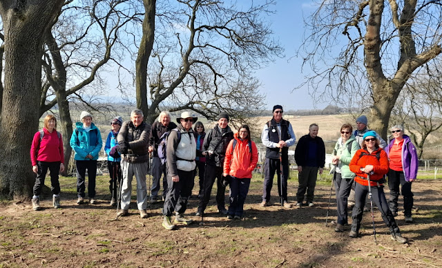
This was a recce of a 7-mile walk from Rufford Mill, through Rufford Country Park and along the Robin Hood Way to the River Maun near Edwinstowe, returning beside the High Marnham Test  Track originally used to deliver coal from Thoresby Colliery to High Marnham Power Station.  The route could be extended to 10½ miles by going north into Sherwood Forest and visiting the Major Oak and the Edwinstowe Visitor Centre before rejoining the railway.

The route was unsatisfactory due to excessive road walking and dangerous crossings.  Better options are to use the RSPB car park in Edwinstowe to access Sherwood Forest or to use a route from Rufford Mill to Ompton and Wellow but this depends on whether you can access the Robin Hood Way from Rufford Country Park.

Rufford Mill, once a corn mill for the Rufford Abbey estate

Rufford Abbey, originally a Cistercian abbey founded in 1145, it was converted to a country house in the 16th century after the Dissolution of the Monasteries

Bronze sculpture in Rufford Country Park

Rufford Gardens

Attractive piece of industrial archaeology - Thoresby Colliery Junction Signal Box

Distant view of theThoresby Colliery site and tip now being redeveloped

Rufford Mill Ford - for more exciting images see YouTube


Huthwaite and Nottinghamshire's Three Peaks, 20th March 2022

John's 8½ mile (other distances are available) walk took nineteen of us through Brierley Forest Park near Huthwaite along a short section of the Teversal Trail and up to our first peak (204.3m) at Silverhill.  We dropped down to Stanley for lunch before climbing up to our second peak (205m) at Newtonwood Lane on the Nottinghamshire/Derbyshire boundary. Our final peak (202m) was reached at Strawberry Bank which claims to be the highest natural peak in the county. Some took a short cut along the Teversal Trail but did not receive their mountaineering certificates.

In commemoration of 20 miners who were seriously injured by fire and the five men that died of their injuries in the Sutton Colliery (Brierley Pit) disaster on 21st February 1957

Teversal Trails Coal Garden, incorporating a variety of artifacts from the local colliery, marks the entrance to the trails - coffee stop

Vintage methane pump at the Visitors Centre

Climbing up to the top of the Silverhill tip on good trails

Keeping the miner company

Testing for Gas was created by artist Antony Dufort as a tribute to the miners of the Nottinghamshire coalfields and commemorates coal mining at the 85 Nottinghamshire collieries (see below)


The names of the principal collieries in the county, 1819–2005

The site at Newtonwood Lane, although unmarked (and unremarkable!) at a location on the edge of a service reservoir, like Strawberry Bank is considered to be natural and at 205m is now officially the highest point in Nottinghamshire

Climb up to Strawberry Bank - the highest habitation in the county

Strawberry Bank

Strawberry Bank - it has its own plaque and viewpoint declaring it as (another) highest natural point in the county at 202m


Beeston Lock and Attenborough Nature Reserve, 13th March 2022

Phil led fourteen ramblers on a nine mile walk around Attenborough Nature Reserve on paths and tracks with no mud or stiles to challenge us. The group spied many rare birds including egrets and other water species. Coffee was taken at the Visitors Centre and lunch on the bank of the River Trent. The finish was at Beeston Marina with a welcoming Robin.

"This area of the Nottingham Canal, originally known as the Beeston Cut, was opened in 1796 with the first boat travelling on the first of March that year.  It was built as an addition to the Nottingham Canal which was developed to ensure that collieries near Nottingham could transport their coal as easily and cheaply as those located near the Erewash and Cromford Canals"

The start

Entrance to Beeston Lock

ITMA


Steve's photos got mixed up with those from his holiday in Patagonia

ITMA & A

Enjoying lunch


One of the rare birds


Barnstone, Grantham Canal and Granby, 6th March 2022


Steve D led twenty four ramblers on an eight mile walk starting at Barnstone Village Hall. The walk passed the Barnstone cement works and by Langar Airfield before we stopped for coffee at Dove Cottage. Then we walked along the Grantham Canal passed Plungar before turning north near Barkestone le Vale towards Granby on the Gypsy Lane farm track. Due to the heavy recent rain the walking conditions were muddy.  Lunch was taken at Granby Church and nearby public benches. The final stretch was past the pub in Granby and then across the River Whipling near Station Farm to reach Granby Lane near the church in Barnstone.

Barnstone Village Hall

Steve briefs the troops

Cement works

Dove Cottage

Steve leads, everyone follows (usually)


Memorial to crew of Lancaster bomber next to the canal towpath

All Saints Church, Granby - lunch stop

Welcome returnees