Hickling, Old Dalby and Upper Broughton, 30th May 2021

Starting at Hickling Basin, today's 9½ mile walk explored the hilly ground on the southern border of Nottinghamshire with a short excursion across into Leicestershire for lunch in Old Dalby.   A good turnout again, twenty one, in fine weather with good views in all directions.


Hickling Basin on the Grantham Canal

Climbing up Hickling Standard with views across the Vale of Belvoir

Clever cows know all about staying 2m away from ramblers

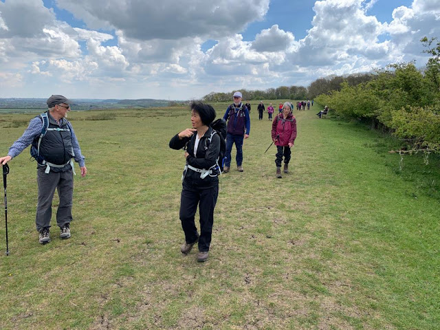
Ladies first.  This route would have been tricky in wetter weather due to the many stiles and muddy patches caused by the inquisitive cows.

To an appreciative crowd, John explains the third-rail system on the Old Dalby Test Track ...

...  used in 1984 to test crash a nuclear waste flask

Old Dalby, Leicestershire Wolds in the background

Old Dalby, Belvoir Ridge in the background
Descent into Old Dalby on Debdale Hill

St John the Baptist Church, Old Dalby - lunch stop for some

St Luke's Church, Upper Broughton

Dalby Wind Farm (7.2 MW) in the distance

The end for some ...

... the Plough for others, opened for the first time this weekend after five recent floods

Incidentally, in view of the difficulties some (many?) of us are experiencing getting over stiles, you may be interested in this excellent publication from Durham CC, Guidance on stiles and gates.  The single most important feature I think is probably the distance between the top step and the top bar which should be no more than 350mm, i.e. about half my inside leg measurement, not slightly more than like yesterday.  Ouch!


Radcliffe on Trent and Cotgrave Country Park, 23rd May 2021

Heather led 16 ramblers on an 8.5 mile walk. Starting at the Health Centre in Radcliffe, the group walked across fields and tracks to Cotgrave Country Park and returned via The Greenway, the new multi-use track along the disused railway,  some walkers opting for shorter return walks at 4 and 6 miles.

Heather briefs us at the start ...


... and leads the way

Coffee stop

Friends reunited

Carrie in charge again

(Very) distant view of Ratcliffe Power Sation

Canal lock in Cotgrave Country Park

Lunch in the park


Southwell, Goverton, Bleasby and Morton, 16th May 2021


Twenty one on John's walk from Southwell, through the Brackenhurst Estate to Goverton and Bleasby and then on the Morton for lunch.  And then back, passing near Potwell Dyke Grasslands where, hopefully, we will be viewing orchids on an Evening Stroll in June.

It was this big, honest

Nottingham Trent's Brackenhurst Estate

Yet again, John organises a train to coincide with his walk

Fine garden in Morton

Church of St Denis, Morton - lunch

Southwell Minster peeping over the trees


Plungar, Granby and Barnstone, 9th May 2021

Again a good turnout (21) for Steve's 9½ mile walk from Plungar, first across fields to join Gyspy Lane which runs from Barkestone to Granby, then through Granby to join a well-surfaced bridleway which connects the Granby and Langar Roads, leaving it to climb up to Barnstone for lunch.

After passing by the cement works and biodigestor, we joined a path to reach the tea rooms at Dove Cottage before returning to Plungar along the nearby Grantham Canal.

Steve briefs us near the church in Plungar


St Helen's Church, Plungar

 Gypsy Lane with views towards Granby.  This is designated as a BOAT (Byway open to all traffic) with a speed limit of 60mph

Village sign, Belvoir Castle nearby (not)

River Whipling just outside Granby

Lunch in Barnstone - defibrillator on standby in the telephone box just in case

Barnstone Cement Plant

Merrivale Energy Anaerobic Digestion facility

Our Leader - with Steve

Returning along the Grantham Canal - Bridge 46


Old VBR Walks Programmes, 1996 and 1998

 
VBR was founded in May 1995 and it's interesting to see how our current activities compare.  Gail has dug out some examples of  Programmes from 1996 and 1998 and you can see below where we used to walk.  In brackets are the numbers on walks, as many as 43 in one case!

Bottesford to Allington, 6 miles (43)
Branston and Croxton Kerrial, 5 miles (23)
Brooke, near Oakham, 10 miles
Calverton and Oxton, 9 miles
Farnsfield, 6 miles
Frogatt Edge and White Edge, 7 miles
Fulbeck, 5.5 miles
Gingerbread Way, 5.5 miles
Gotham, Barton and Thrumpton, 8 miles
Kinoulton, Colston Bassett and Cropwell Bishop, 7 miles (30)
Lambley Dumbles, 7 miles (18)
Mowbray Way, 8 miles (20)
Old Dalby, 8 miles (19)
Scalford, Ab Kettleby and Holwell, 6 miles (15)
Swinstead and Edenham, 8 miles
Wetton and Thor's Cave, 6.5 miles (17)
Woodhouse Eaves, 9.5 miles
Weekend Away - Yorkshire Dales

Some more observations:
  • Walks took place once a fortnight.
  • You will recognise only a few of the leaders of the above walks, Eileen, Gail, Ken Brockway and Brian, though there are others stil walking with us from those days.
  • We occasionally had guest leaders.
  • Members met up in Bottesford before walks to share cars.
  • Start times varied.
  • Good walk descriptions.
  • Pub stops and lunches were frequent!
  • Contact details - surnames but no telephone numbers
  • No post codes for start points but good directions.
Where are they now?

West Leake Hills, 2nd May 2021

Paul's walk took 22 of us through the churchyard of St Helena's, West Leake, and south over Kingston Brook before recrossing it to ascend the West Leake Hills to our target for the day, the famous Cuckoo Bush.  Fine weather, good tracks and good views.

Paul briefs us at the start

St Helena's Church

A constant companion.  You'll miss it when it's gone

I'm sure its over there!

The Cuckoo Bush Mound is the alleged site for the tale of the Wise Men of Gotham's attempt at fencing in the cuckoo, but is actually a Neolithic burial mound. It's about 3000 years old and was excavated in 1847

And here it is at last - the Cuckoo Bush Mound itself

Lunch.  West Leake Hills, view south towards Beacon Hill

Approaching West Leake at the end