Dry Doddington and Westborough, 28th January 2024

 Dry Doddington is situated on the Lincoln Hill (47m above sea level) and overlooks the Witham Valley to the south and west about 25m lower down.  John's 8¼ mile started near the Wheatsheaf Inn in the village and took 29 members along lanes and tracks in the direction of Stubton to cross over the East Coast Mainline but turned south to avoid the mud in this flat part of Lincolnshire.  After crossing under the ECML we headed to Westborough along quite lanes for lunch before climbing Lincoln Hill back to the start. Total ascent for the day - 39m.


St James Church is a Grade II listed building dating from the 12th century. Its tower leans by about 5°, more than the Leaning Tower of Pisa

The start

Coach Road out of Dry Doddington

Copley 30 MW Solar Farm - quite large by the standards of the day in 2016

Over the East Coast Mainline ...


... and under it

Another fine mess you've gotten me into, John

Lunch in Westborough

Fine brickwork at Ease Lane Farm

Almost back - distant view of the Wheatsheaf Inn

Cleaning off the mud at Dry Doddington Village Hall


Bradgate Park and Beacon Hill, 21st January 2024

 Making extensive use of both the Leicestershire Round and the National Forest Way, Scott's 8-mile, hilly walk (ascent 313m) took us round the perimeter of Bradgate Park before heading across Lingdale Golf Course towards Broombriggs Country Park. Then, after entering Beacon Hill Country Park, we climbed up to Beacon Hill itself and dropped down to the South Car Park for lunch.  Ignoring a climb up to Windmill Hill, the route took us back through Woodhouse Eaves and past the slate quarries in Swithland Wood.

Scott briefs us in Swithland Wood


Entering Bradgate Park

Coffee stop after leaving the golf course

Distant view of Old John Tower


Man and Ram - one of many wooden sculptures in Beacon Hill Park

The Beacon - trig point just visible in the distance

Trig point (248m)

Workshop of Peter Leadbetter, local chainsaw artist in residence

Beacon Hill Cafe - lunch nearby

Approaching Woodhouse Eaves

Folly next to one of the many slate quarries in Swithland Wood, some dating back to Roman times  


Blidworth Wood, Papplewick Pumping Station and Sansom Wood, 14th January 2024

On a dry day for once, twenty six ramblers came on this 5.6 mile morning walk starting at the Forestry England car park at Blidworth Wood, Longdale Lane, Ravenshead.  After heading for Blidworth Bottoms in the wood, we returned to Longdale Lane and crossed into Sansom Wood to eventually reach the entrance to Papplewick Pumping Station.  Returning to Sansom Wood, we reached the very deep cutting of the disused Bestwood to Calverton Pit Railway line, crossing it at the Rigg Lane Bridge. A further 45 minutes took us back to the start point through trees severely damaged in winds just before Christmas.

The start in the dog-walkers' busy car park


Setting out on dry, firm paths and tracks

Sykebreck Farm from Blidworth Wood

Other users near the Rigg Lane car park

Coffee stop

Three Wise? Men

First view of the Pumping Station chimney across ponds which were presumably used to store water when the station was in use.  There is a nearby Nottinghamshire Wildlife Trust Toad Patrol similar to the one near Oxton

Papplewick Pumping Station entrance, Superintendent's House in the background

What we missed - taken in October when the Pumping Station was open


Near the car park, colliery winder brakes from one of many local pits

Steep descent into the Calverton Pit railway cutting

Rigg Lane bridge

One of many recently uprooted trees in Sansom Wood

Before the storm, October 2023

After the storm, January 2024.  Some trees snapped off at the base and many halfway up

Sansom Wood Farm


Nottinghamshire floods, January 2024

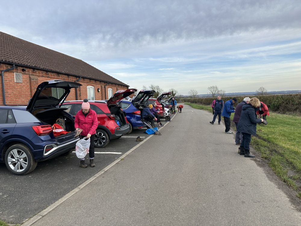
 Following a recent recce, Paul has decided to cancel the walk from Linacre Reservoirs on 14th January due to adverse ground conditions and the resulting danger of slipping - see photo below.  An alternative walk starting at Blidworth Wood has been recced to confirm conditions are OK - see Walks Programme.

Flooding near the start of the Linacre walk

Nottingham, of course, has this week seen some of the highest river levels for some time and Gunthorpe in particular has been badly affected. Here are some photos taken when the Trent was at its highest on Thursday 5th January.

View from Gunthorpe Bridge

The Unicorn, Trentside

Main Street, Gunthorpe closed as was the A6097

Caravan Park

The River Trent stayed high for several days as shown below.  It's interesting to see how the the data for the Cocker Beck which affects Lowdham showed a completely different pattern, the water rising and falling over hours rather than days reflecting the small size of the catchment area.  Note also that the peak on Tuesday occurred when the Trent levels were low demonstrating the absence of any backup from the Trent itself which the Cocker Beck joins just upstream of Gunthorpe.  This can be confirmed by looking at the long-term data - all the highest levels of the Cocker Beck occurred in advance of any significant rise in the level of the Trent.

The peak in the Trent travels downstream at about one mile per hour, slower than the speed of the current

Some River Trent statistics at Colwick (cubic metres per second)
average flow - 84
minimum flow - 15
maximum flow - 1,018