Swayfield, Castle Bytham and Creeton, 25th August 2024

John's 8.7 mile walk took twelve members south of Swayfield to Castle Bytham in the catchment of the Glen Rivers, returning past Creeton and then up The Drift

Thanks John for the photos and video.


The start on The Drift near Swayfield

Never far away - the East Coast Main Line

Very hard going on recently ploughed fields ...

... or stubble

Maize, intended for the nearby anaerobic digester (AD)

Massive fields of maize

Whatever your views on the best use of farmland, for food, biodiversity or energy, biocrops must rate bottom.  Why?
Maize has a singularly harmful impact on soils.
Solar PV generates 12–18 times more energy per hectare than maize grown for AD.
Yet,  nearly a third of maize grown in England is grown as a bioenergy crop for AD


One of many limestone quarries in the area

 Castle Bytham was well-established by the time of the Norman Conquest of 1066 and was known by the ancient name of Westbitham. The original motte and bailey castle probably dates back to the Domesday Book which was compiled in Lincolnshire in 1085.  The castle was destroyed in 1220, rebuilt, fell into decline, used as a quarry for building material and only the motte now remains

Crossing (under) the East Coast Mainline for the second time

Just south of here, on 3 July 1938, Mallard claimed the world speed record for steam locomotives at 125.88mph

Heading south at speed


And back up The Drift to the start

Today's route in red and others done recently

Lowdham Church and Lambley, 18th August 2024

Starting in the church car park in Lowdham, Howard took us on a 9.1 mile walk exploring the high ground north of the Cocker Beck on excellent tracks and field paths.  We started by walking to the original start-point on Rockleys View, the access road to the rear entrance to Lowdham Grange which we passed on the way to Ploughman Wood Nature Reserve.  We later dropped down to cross Lambley Dumble for lunch next to the school before returning to Lowdham afer some more climbing.

Thanks Bill for the photos.

St Mary's Church, Lowdham

The start in the church car park

View of the site of Lowdham Flood Storage Reservoir, due to be completed in 2027

Setting off


View over Woodborough
Another ascent, Woodborough in the distance

Overgrown in places

We were warned about the odd horse - 7 or 9 today

Lunch near the school in Lambley

Crossing Lambley Dumble for the second time, just behind The Woodlark Inn


Tibshelf and the Five Pits Trail, 11th August 2024

 The Five Pits Trail was created in 1989 and follows the route of the former Great Central Railway which served the five main coal mines of Grassmoor, Williamthorpe, Holmewood, Pilsley and Tibshelf.  Today, Sue and Dave Cobley led eleven ramblers on an 8-mile walk on the trail beginning at the Timber Lane car park north of Tibshelf. The first mile was across open fields in the hot sunshine but most of the remaining walk was along stone tracks with a good degree of overhead tree shade.

Thanks Steve and John for the photos.


Sue briefs the members

Our Leader

Dave making a temporary repair to ensure safe traverse of a stile


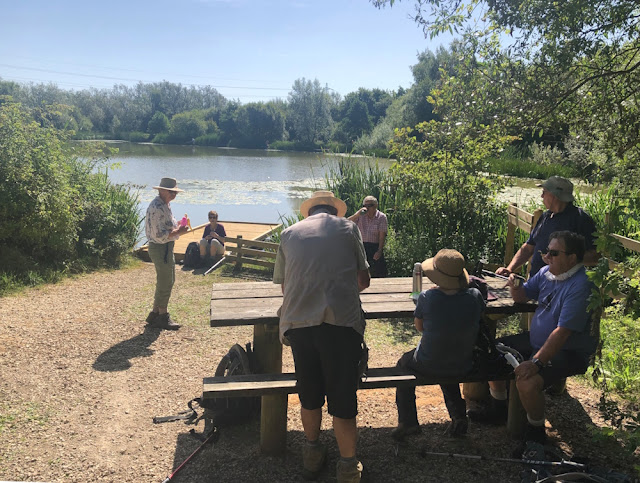
Coffee stop


Lunch stop


East Bridgford Evening Stroll and Skittles, 6th August 2024

Starting at the Royal Oak, Sue took eighteen members and guests on this 3½ mile Evening Stroll p
ast Stokes Mill to the edge of Springdale Wood before turning to pass through the lanes of the village.  After crossing fields to the north east, we walked along Occupation Lane to join Kneeton Road and head back into the village to join other VBR members at the Royal Oak for skittles, food and drink.

Thanks Sue for leading the walk and arranging the Skittles Evening, especially the food!
Sue briefs the group outside the Royal Oak

Stoke's Mill and mosaic


Approaching Occupation Lane

Distant view of the windmill on Kneeton Road

Goldendrops Bee Farm, Kneeton Road
https://goldendrops.co.uk/

And back ...

... for entertainment provided by our Chairman John and his Assistant Scorer, Teacher Elaine


Croxton Kerrial and Branston, 4th August 2024


Outnumbered!  Fourteen ladies and just four gentlemen on Susie's 5-mile walk from the Geese and Fountain at Croxton Kerrial.  The route took us south towards Croxton Park then turned north west towards Branston for a well deserved drinks stop.  An undulating walk in uncertain weather.


The closed Geese and Fountain pub showing the nearby water spout on the main road and some rusty geese

The start in the layby near the pub

Crossing the River Devon close to its source in Croxton Park

View towards Belvoir Castle

Cast iron-clad pump at Branston with a low panel featuring a stylised peacock which forms part of the coat of arms of the Duke of Rutland


The Old School House, Branston - seen better days

The Wheel Inn, Branston

St Guthlac's - drinks stop

Field of Lacy Phacelia
This cover crop is a rapidly growing, high biomass plant, a nitrogen holder and weed suppressor. Its eye catching purple flowers are particularly good at attracting bees and other beneficial insects. Used as a soil improving green manure