Howard took twelve of us on this 5-mile walk starting at St Mary's Church, Lowdham before crossing through the village and climbing up over hills before dropping down to the Dover Beck and two old water mills, Cliff Mill and Hoveringham Mill. Circumnavigating Hoveringham fishing lake, we stopped at St Andrew's Church, Gonalston before making our way back via Lowdham Mill (also known as Carby's Mill).
 |
| Some information on Lowdham Village |
 |
| St Mary's Church, Lowdham |
 |
| Crossing Cocker Beck in Lowdham, source of much recent flooding |
 |
| Cliff Mill |
 |
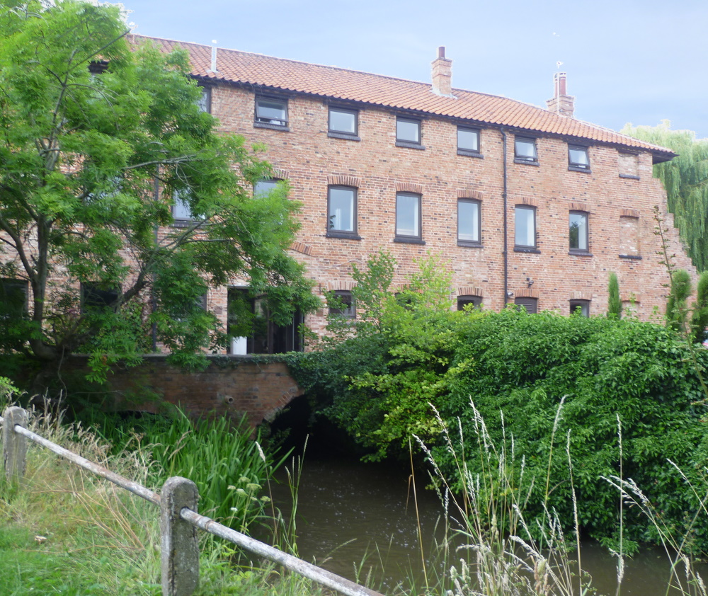
| Hoveringham Mill on the Dover Beck. The Beck was the southern boundary of Sherwood Forest from the 13th century. The river rises near the village of Blidworth in the heart of the forest and flows southeast to join the River Trent near Caythorpe. The mill was one of eleven on the Dover Beck: Salterford Mill, Oxton Mill, Epperstone Mill, Woodborough Mill, The Paper Mill, Carby’s Mill, Parkinson’s Pit, The Lord’s Mill, Cliff Mill, Hoveringham Mill and Caythorpe Mill. See Mills on the Doverbeck by W A James for more information. |
 |
| First cattle, then goats, then horses and, for the first time, pigs obstruct our path |
 |
| St Lawrence's Church, Gonalston |
 |
| Two tracks were recorded, one with a smartphone (see inset) which recorded and stored (4800) data points once per second and one with a Garminn GPS device which recorded (368) data points at the same interval but stored them only if there had been a movement of 20m or more. The track distance of the latter (just under 5 miles) is the one closest to that measured using a piece of string. The smartphone overestimated the distance by about 10% and this is likely to always be the case when so much data is collected |


