Manifold Valley and surroundings, June 29th 2014

 Over thousands of years the River Manifold has carved out a steep sided valley into the limestone plateau of the White Peak.  One of the characteristic features of the river and other limestone rivers such as the Dove is that for part of their length they flow underground except when in flood.  The Manifold originates high in the moors close to Axe Edge and flows twelve miles south through the small villages of Longnor and Hulme End, the start of the walk, before disappearing just past Wetton Mill.  It reappears in the grounds of Ilam Hall just before its confluence with the Dove near Thorpe Mill.  Rod's route today makes use of part of the trail in the valley and explores the high ground on either side.


Ecton Mine buildings
near the start of the walk
Ecton Mine was almost unique in being a rich copper mine in an area of Derbyshire usually associated with lead mining.  The ore was formed by hydrothermal fluids rising in vertical fissures in the rock 180 million years ago and is concentrated in a vertical quasi-cylindrical pipe which surfaces at the top of Ecton Hill and is approached horizontally along a tunnel cut into the hill from the mine buildings.

Although it is thought that Ecton Hill was mined in the Bronze Age, it was not until 1760 that the it was developed seriously when the Duke of Devonshire assumed direct control and major investments were made.  By 1767 the mine was 290m deep and 130m of this was below the Manifold and had to be artificially drained.  Ecton was briefly the most prolific copper source in the world, and the Duke was able to use it to finance his construction of a new spa resort at Buxton.  By the 1780’s Ecton’s 4000 tons per annum output was equivalent to 12% of the entire output of Cornwall’s many copper mines and the mine was the deepest in the world. Further reserves were made accessible by installing a Watt steam engine and by 1795 the Ecton Deep Shaft was 400m deep with 280m of this was below the Manifold.  An interesting description of the engine can be found at https://www.flickr.com/photos/7382107@N04/474794116/


Looking back towards the Ecton Mine in the Manifold Valley


Overlooking the Manifold Valley looking west towards the Staffordshire Moorland


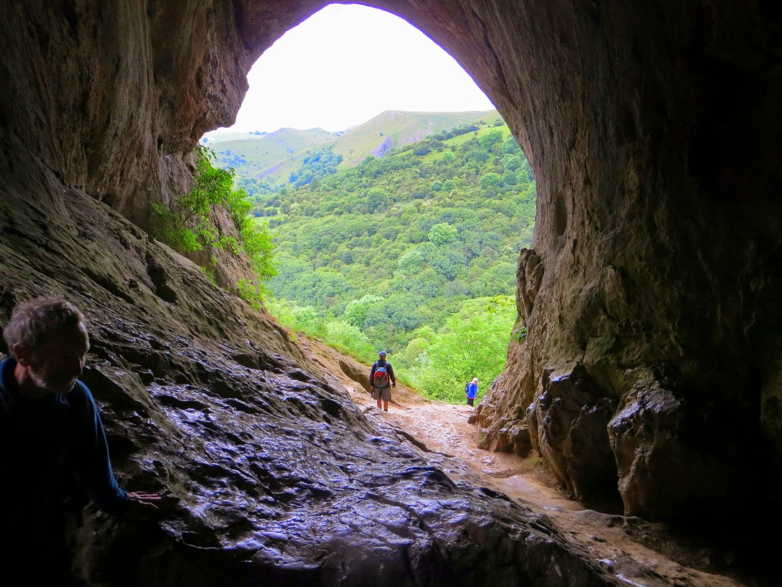
Thor's Cave - single click on any image in this blog to enlarge; esc to go back.


Lunch stop with Thor's Cave in the background. Eileen gives an important warning about Lyme disease caused by being bitten by an infected tick.


The walk ended at the former engine shed of the Manifold Valley Light Railway (1904 -1934), a narrow gauge railway which carried milk from dairies in the region and acting as a feeder to the standard gauge system. It also provided passenger services to the small villages and beauty spots along its route.  It started near the rail link to Leek at Waterhouses, descending the valley of the Hamps river before climbing up the Manifold to Hulme End.  The railway has been converted into a popular cycle track. 


Blidworth, June 2014

Thanks to Steve and John for these images.


Bernard tries yet again to talk to the animals


Join the Ramblers for friendship and fun!

Hallaton and Neville Holt, 25th May 2014

Thanks to Gordon for the following photographs.
(Single click to enlarge images, esc to go back to blog)
 

Grantham Canal, 21st May 2014


(Single click on an image below to enlarge, esc to go back to blog)


Cotgrave Country Park and Grantham Canal, 18th May 2014

(Single click the images to enlarge)


Beacon Hill and Bradgate Park, 11th May 2014

Sorry if you have heard this tale before but ....

Bradgate Park is famous for its geology having probably the oldest rocks in England. Some of them are Precambrian i.e. older than the Cambrian Period which started about 540 million years ago. Now until the late 1950s the accepted scientific view was that life did not emerge until the Cambrian period. The so-called Cambrian Explosion was the period in which most major animal phyla appeared. However, on a trip to the park in 1956, a young Leicestershire schoolgirl Tina Batty found what she though was a fossil in a Precambrian rock face and told her geography teacher. "What have I told you" he said, "Precambrian rocks do not have fossils. Go to the bottom of the class". Then, the following year, a young lad Roger Mason saw what looked like marks on the same rock surface which, cutting a long story short, were identified as a fossil and this was subsequently named Charnia masoni. 

Roger Mason went on to become a Professor of Geoscience. As for Tina – who knows! 


Six of one, half a dozen of the other


A taste of things to come - Teesdale in September 2014


More information on the Weekend Away will be available later in May.  In the meantime .....

On the Pennine Way

Middleton in Teesdale

Low Force

Upper Teesdale

Tees Railway Path


Collingham, the Trent and Besthorpe Lagoons, May 4th 2014


The start of the walk, The Green at Collingham


Cromwell Weir by the side of the lock is one of the largest (and most dangerous) weirs on the Trent and marks the tidal limit of the river.


The wall of North Collingham Church, facing Carlton Ferry Lane, has marker stones let into its structure recording heights and dates of various notable flood events. These go back as far as February 1795 when one such flood was so severe that the river gave up its course for a while and flowed through a low piece of ground, between Newark and Stapleford, into the River Witham and retook its old route (pre ice age) to the sea at Boston on the Wash.  Later floods have been less severe due to the building of flood defences.


Even more interesting than the birds is the history of the Trent Valley gravel pits.


And at the end of the walk, even more interesting bird life.

Bourne Woods, 20th April 2014

Here is a track downloaded from a Garmin GPS and plotted on top of an OpenStreetMap map.  Notice the dropouts as we walked through the woods due to the poor signal reception.  On the original Garmin Etrex the gaps are not included in the overall trip distance and this is one of the sources of the discrepancies we get in this value at the end of a walk.

At last, Bernard finds a soulmate

Shillito Woods revisited - 13th April 2014

No wonder we were all so tired at the end of this walk - the distance covered was 19.6 km (12.2 miles) and the height gained (and lost) 890m.


Gunthorpe, Caythorpe, Lowdham, Lambley and Bulcote, 16th April 2014

Gonalston Mill

The Doverbeck River was the southern boundary of Sherwood Forest from the 13th century. The river rises near the village of Blidworth in the heart of the forest and flows southeast to join the River Trent near Gunthorpe and Caythorpe. The Gonalston Mill, formerly known as Cliffe Mill, was one of eleven on the Doverbeck. The eleven were: Salterford Mill, Oxton Mill, Epperstone Mill, Woodborough Mill, The Paper Mill, Carby’s Mill, Parkinson’s Pit, The Lord’s Mill, Cliffe Mill, Hoveringham Mill and Caythorpe Mill. 

See Mills on the Doverbeck by W A James for more information. 

St Mary's Church, Lowdham

Six (or seven) Holmesfield halls, 13th April 2014

This walk, led by Eileen, took us to seven halls in the Holmesfield district of Derbyshire, just outside the National Park and overlooking Sheffield and Chesterfield.

(Single click to enlarge images).


The ancient cross near the start of the walk at Shillito Woods was known as Bole Hill Cross or Shepherd’s Cross on the Victorian Ordnance Survey maps. It was probably erected by monks from Beauchief Abbey in the 13th century on an old packhorse route west from the Rother Valley across Ramsley Moor.
Ramsley Moor

Foxlane Plantation


1 Horsleygate Old Hall

2 Horsleygate Hall


3 Fanshaw Gate Old Hall garden


3 Fanshaw Gate Old Hall


4 Woodthorpe Hall


5 Holmsfield Hall


6 Cartledge Hall


7 Unthank Hall