Rosedale Abbey and the Ironstone Railway
Starting in the village of Rosedale Abbey, this walk explored the Rosedale valley and nearby moorland. Mining for iron took place here for hundreds of years before the 19th century mining boom which followed the discovery of thick seams of ironstone outcropping near the surface in Rosedale. Most of the walk was along the the track bed of Rosedale's Ironstone Railway which follows the contours round the head of the valley along which mining and other activities were once carried out.
 |
| The start in Rosedale Abbey |
 |
| Today's walk (red) with other options up the River Seven (green) and round the head of the valley on the railway (blue) |
 |
| First sight of the Ironstone Railway - Rosedale East Coal Depot with its stone dividing walls to separate fuel types |
 |
| Looking up Rosedale towards the head of the valley |
 |
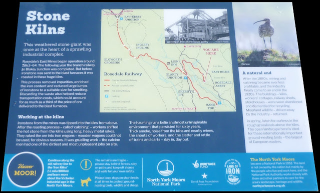
| The Rosedale Iron Kilns were one of three sets where ironstone was calcined (roasted) before being taken to Teesside for iron and steel production |
 |
| Model of ironstone kilns |
 |
| Rosedale Mines Iron Kilns, 1900 |
 |
| The kilns were built in the 1860s to process ironstone which had been mined from beneath the moor to the east |
 |
| Descent from the railway |
 |
Re-joining the railway at Blakey Junction where the East and West branches of the Ironstone Railway meet
 | | Example of mining technique at Sheriff's Pit just before leaving the railway |
|
 |
| Welcome rest at Thorgill after dropping down from the railway over rough moorland |
 |
| All that's left of Rosedale Priory, the 13th-century turret near the Church of St Mary and St Laurence in the village of Rosedale Abbey |
Tuesday, Whitby and the Cinder Track
Today's walk started at Larpool Hall and immediately joined the Cinder Track, the bed of the 21-mile disused railway from Whitby to Scarborough which closed in 1965. After 2½ miles we turned off towards the coast and followed the cliff top to pass by Whitby Abbey and explore the town. From Whitby, a climb took us up to re-join the Cinder Track and walk back across the Larpool Viaduct to Larpool Hall.
Boggle Hole to Ravenscar
 |
| Robin Hood's Bay to Ravenscar |
 |
| Boggle Hole, 2009 |


